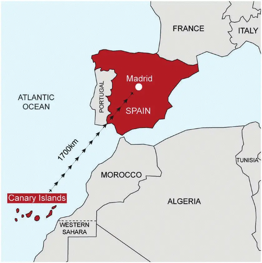
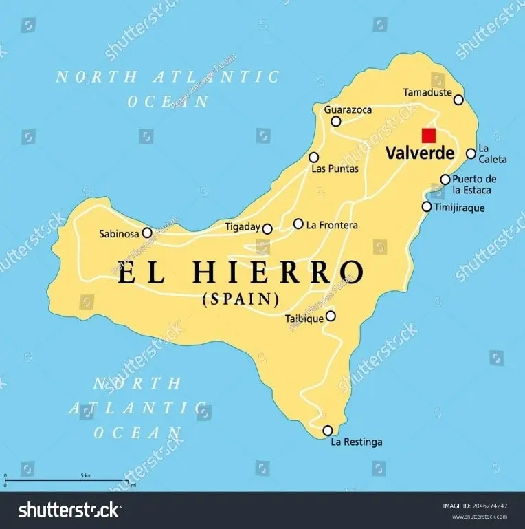
Canary Islands Map for UPSC CSE
This page contains the map of Canary Islands which is in news. We have added important notes on it as well.


Rescue crews are searching for 48 migrants missing after a boat capsized near El Hierro, one of the Canary Islands. This could be the deadliest incident in 30 years of crossings from Africa to the Canary Islands.
About Canary Islands
-
Location:
- Archipelago in the Atlantic Ocean, about 1,300 km south of mainland Spain and 115 km west of Morocco's coast.
-
Controlled by:
- Part of Spain.
-
Origin:
- Formed by volcanic eruptions millions of years ago, creating a unique volcanic landscape.
-
Climate:
- Subtropical with warm temperatures and minimal seasonal variation.
-
Vegetation:
- Rich volcanic soil supports diverse vegetation, varying with elevation.
El Hierro Island
-
Location:
- Southernmost and westernmost of the Canary Islands, near the African coast.
-
Features:
- Known as the “Meridian Island”, with volcanic landscapes, rugged terrain, and a subtropical climate.
-
Size:
- Second-smallest of the main Canary Islands, covering 268.51 square km.
-
Capital & Population:
- Capital: Valverde. Population: ~11,659 (2023).