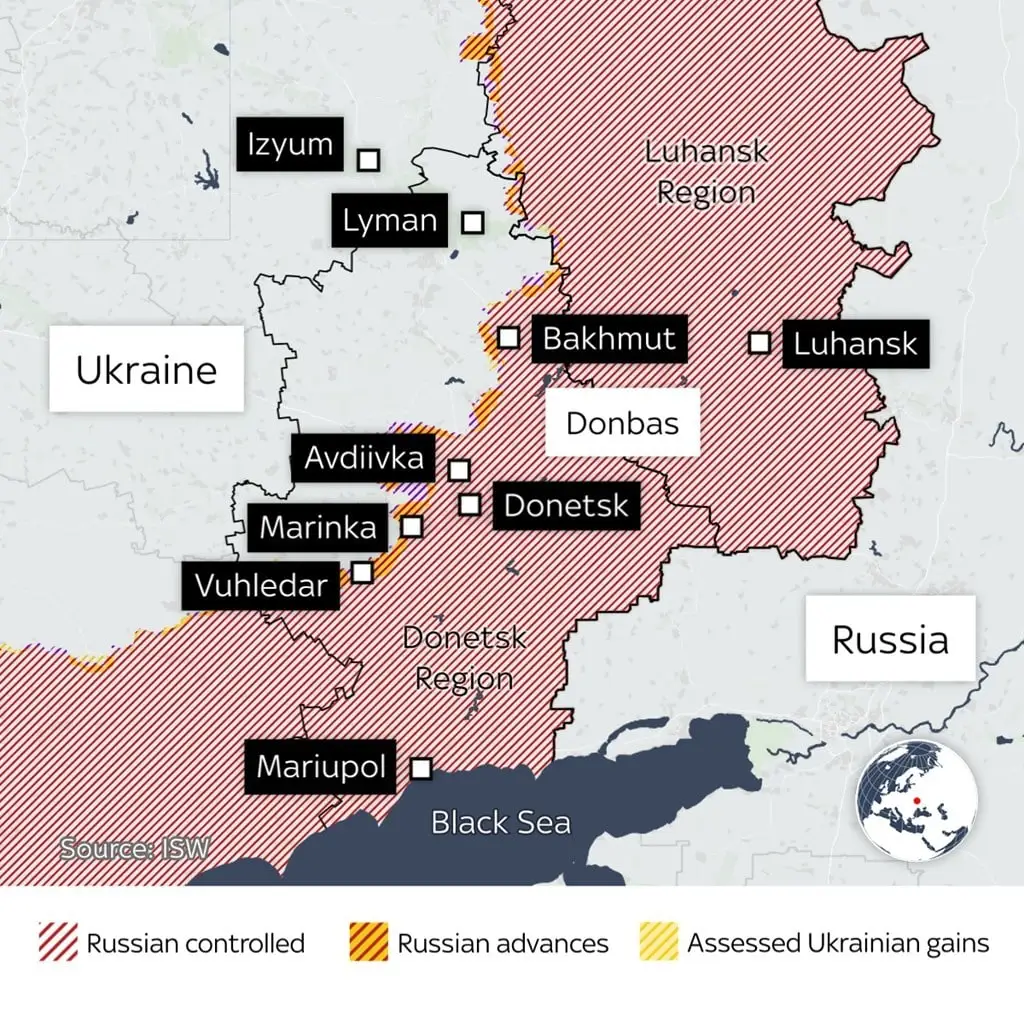
Vuhledar Map for UPSC CSE
This page contains the map of Vuhledar which is in news for being the site of heavy fighting between Ukrainian forces and Russian-backed separatists.
-
Russian troops have gained full control of Vuhledar, an eastern Ukrainian city, amidst the ongoing conflict in Ukraine.
-
About Vuhledar:
- Location:
- Situated in Volnovakha Raion, Donetsk Oblast, eastern Ukraine.
- Located about 57 km southwest of Donetsk.
- Geographical Importance:
- Vuhledar sits on an elevated plain, making it the highest point in the region and giving it strategic military value.
- Russia's control of this city is part of its effort to push further north toward transportation hubs like Kurakhove and Pokrovsk.
- Economic Background:
- Developed during the 1960s with plans to become a major center in the coal industry of the Donbas region.
- Although it hasn't grown as expected, it remains economically tied to coal mining.
- Geological Importance:
- Vuhledar is located in the Donbas region, known for its rich coal reserves, contributing to Ukraine’s coal production.
- Location:
Ukraine's eastern industrial areas, including Vuhledar, are crucial to both the ongoing conflict and the global energy landscape, as coal still plays a key role in many countries, including India.